Intranet | Webmail | Forms | IITK Facility
![]()
![]()
![]()
![]()
![]()

Ph.D. Research Scholar
|
|
Abhilasha Garkoti B.Tech, M.Tech E-mail: This email address is being protected from spambots. You need JavaScript enabled to view it. Research Area: Environmental Geodesy |
|
Aditya B.tech E-mail: This email address is being protected from spambots. You need JavaScript enabled to view it. Research Area: Urban Forest Characterisation |
|
|
Apratim Biswas M.Tech E-mail: This email address is being protected from spambots. You need JavaScript enabled to view it. Research Area: Remote sensing applications in forestry, Light Detection & Ranging |
|
Arnab Laha B.Tech, M.Tech Webpage: https://home.iitk.ac.in/~alaha/ E-mail: This email address is being protected from spambots. You need JavaScript enabled to view it. Research Area: Remote sensing, Geodesy, Natural Hazards, Earth Orientation Parameters |
|
|
Ashish Katiyar B.Tech E-mail: This email address is being protected from spambots. You need JavaScript enabled to view it. Research Area: Deep learning, machine learning, remote sensing, Lidar, autonomous vehicle |
|
Ashwani Kumar B.Tech, M.Tech E-mail: This email address is being protected from spambots. You need JavaScript enabled to view it. Research Area: Indoor Navigation using sensor fusion |
|
|
Aswani Kumar Munnangi B.Tech, M.Sc., M.Tech E-mail: This email address is being protected from spambots. You need JavaScript enabled to view it. Research Area: Land Administration, Land Consolidation, Cadastre, Land Informatics |
|
Digvijay Singh B.Tech, M.Tech E-mail: This email address is being protected from spambots. You need JavaScript enabled to view it. Research Area: GRACE data processing |
|
|
Gowripeddi Pranavi B.Tech, M.Tech E-mail: This email address is being protected from spambots. You need JavaScript enabled to view it. Research Area: Geodesy - SLR and its applications |
|
Ibaad Anwar B.Tech, M.Tech E-mail: This email address is being protected from spambots. You need JavaScript enabled to view it. Research Area: High rate GNSS data analysis for seismology |
|
|
Jagadish B B.Tech, M.Tech E-mail: This email address is being protected from spambots. You need JavaScript enabled to view it. Research Area: Cartography, Map generalisation |
|
Jamil Mahmood M.Tech E-mail: This email address is being protected from spambots. You need JavaScript enabled to view it. Research Area: Study of Rainfall using Remote Sensing and GIS appplications |
|
|
Mintesnot Berhanu Tilahun MS E-mail: This email address is being protected from spambots. You need JavaScript enabled to view it. Research Area: Environmental Remote Sensing |
|
Kaustav Saha B.Tech, M.Tech E-mail: This email address is being protected from spambots. You need JavaScript enabled to view it. Research Area: Lidar and Microwave Remote Sensing |
|
|
Komali Bharath Narayana Reddy B.Tech, M.Tech E-mail: This email address is being protected from spambots. You need JavaScript enabled to view it. Research Area: Application of GRACE gravity data to study hydrological changes |
|
Milaa Zyad Murshan B.Tech, M.Tech E-mail: This email address is being protected from spambots. You need JavaScript enabled to view it. Research Area: Geoid Modeling |
|
|
Moonis Ali B.Tech, M.Tech E-mail: This email address is being protected from spambots. You need JavaScript enabled to view it. Research Area: LiDAR in Geoinformatics |
|
Naveen R B.Tech, M.Tech E-mail: This email address is being protected from spambots. You need JavaScript enabled to view it. Research Area: Microwave Remote Sensing |
|
|
Prashant Chuahan B.Tech E-mail: This email address is being protected from spambots. You need JavaScript enabled to view it. Research Area: Parking Management, GIS |
|
Rashmi Malik B.Sc., M.Sc., M.Tech E-mail: This email address is being protected from spambots. You need JavaScript enabled to view it. Research Area: Radar Polarimetry |
|
|
Ratnesh Kushwaha B.Tech E-mail: This email address is being protected from spambots. You need JavaScript enabled to view it. Research Area: Developing software for baseline processing using IRNSS observations |
|
Rohit Rajput B.Tech, M.Tech E-mail: This email address is being protected from spambots. You need JavaScript enabled to view it. Research Area: Autonomous Vehicle, LiDAR, Computer Vision,AI, Machine Learning, ITS |
|
|
Shilpi Chakraborty B.Tech, M.Tech E-mail: This email address is being protected from spambots. You need JavaScript enabled to view it. Research Area: Signal processing in Geoinformatics and Astronomy |
|
Shivangi Singh B.Tech E-mail: This email address is being protected from spambots. You need JavaScript enabled to view it. Research Area: Geodesy, VLBI, Plate tectonics and crustal deformation study, simulation study |
|
|
S. Kirthana M.E. E-mail: This email address is being protected from spambots. You need JavaScript enabled to view it. Research Area: Research work that correlates Water resources and Geo-Informatics |
|
Sri Priyanka Kommula B.Tech, M.Tech E-mail: This email address is being protected from spambots. You need JavaScript enabled to view it. Research Area: Automation of Rainwater Harvesting Structures and their Design using High-Resolution LiDAR Data and Machine Learning techniques |
|
|
Sunil Kumar B.Tech, M.Tech E-mail: This email address is being protected from spambots. You need JavaScript enabled to view it. Research Area: LiDAR, Indoor mapping and navigation, SLAM, Multi-Sensor Integration |
|
Surbhi Barnwal B.Tech, M.Tech E-mail: This email address is being protected from spambots. You need JavaScript enabled to view it. Research Area: Application of Lidar in Forestry |
|
|
Sujata Dhar B.Tech, M.Tech E-mail: This email address is being protected from spambots. You need JavaScript enabled to view it. Research Area: GNSS, Geodetic VLBI, Earth Orientation Parameters, Plate movement studies, Realizations of Terrestrial Reference frames |
|
Vivek Anand B.Tech, M.Tech E-mail: This email address is being protected from spambots. You need JavaScript enabled to view it. Research Area: Integration of UAV and High Resolution Remote Sensing Sensors, Application of RS/GIS in Intelligent Transportation Systems |
|
|
Vikas Balajirao Kapale M.Sc E-mail: This email address is being protected from spambots. You need JavaScript enabled to view it. Research Area: Gravity field |
|
Vikash Kumar B.Tech, M.Tech E-mail: This email address is being protected from spambots. You need JavaScript enabled to view it. Research Area: DORIS in Geodetic Applications |
|
|
Vipul Sharma M.S E-mail: This email address is being protected from spambots. You need JavaScript enabled to view it. Research Area: GNSS |


|
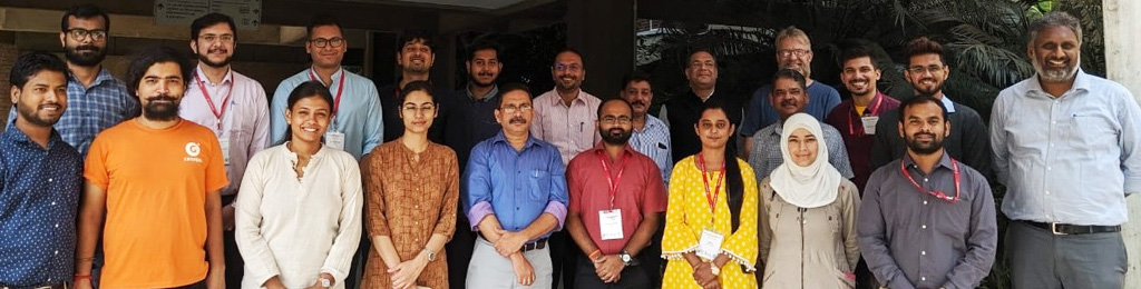
Short Term Course on Introduction to GNSS and Its Applications:
Global Navigation Satellite System (GNSS) refers to the constellations of Earth-orbiting satellites. These satellites are continuously transmitting signals which help to determine the precise three-dimensional position of any point anywhere on the globe. There are various civilian applications of GNSS such as positioning, navigation and timing services, which are widely used in route planning, aviation, location-based services, agriculture and surveying. Apart from general civilian uses, GNSS is widely used in geodynamics research. Particularly in plate motion studies, GNSS has been one of the most relied upon geodetic sensors in the past two decades. Keeping in view the various significant applications of GNSS, this short-term course aims to expand the introductory concepts of GNSS and data processing amongst Indian academia and Industry.
Link for registration: https://forms.gle/jK4z4ebWLmEm7KME6 |
|
Geodesy for Senior level Survey of India
National Center for Geodesy (NCG), the newly started centre at IIT Kanpur is starting a new short-term course on Geodesy for Senior level Survey of India (SoI) officers. It is a two-week course, commencing 19th July 2021 and would continue till 30th July 2021. The course is being conducted online with planned lab sessions followed with hands-on exercises during the labs.
The course would cover fundamental topics on Geodesy such as Marine Geodesy, National Spatial Reference Frame, Satellite Altimetry, Plate tectonic studies and Geoid modeling. NCG is well equipped with expertise and resources to teach the course. The course will be taught by Prof. Onkar Dikshit, Prof, B. Nagarajan, and Prof. Balaji Devaraju, well renowned in the field of Geodesy.
Course capacity: The course is conducted online, and for better interaction we have kept an upper limit of 20 participants.
Lab sessions: It is planned to conduct lab sessions of three hours each from Monday to Friday (in the afternoon). Theory relevant to the lab topics would be first covered in the lectures, followed by hands-on exercise during the labs. Each lab session will be conducted online, where the participants may be allotted remote access to desktop machines where all necessary software would be pre-installed. This requires no more than a working internet connection and a remote desktop connection software. Alternatively, participants can also do labs on their own machines, if they wish to. The pace of labs and lectures would be kept so as to suit the learning capacity of the participants.
Infrastructure required at trainee's end: The necessary requirements are (i) stable internet connection, (ii) video conferencing (Zoom/Webex) and (iii) a remote desktop connection software (TeamViewer, AnyDesk, etc.).
Clarification on budget estimates: Yes, the given budget estimates are for the entire course and are not on per student basis. The estimates cover the complete budget required to run the course.
Modules on Marine Geodesy, National Spatial Reference Frame, Satellite Altimetry, Plate tectonic studies and Geoid modeling: The fundamentals required to understand these topics have been included in this first course. These modules were excluded based on the course duration and the decided pace of instructions. We have expertise available to teach these modules, and will be included in future courses. |
Geodesy Village
 Geodesy, the discipline of measuring and representing the Earth’s surface, is one of the oldest sciences, which forms the fundamental basis for any Earth related studies including its atmosphere, oceans and biosphere. However, knowledge in this subject of basic science has been below par in this country due to many inexplicable reasons. In order to popularise this subject of scientific importance, a National Centre for Geodesy (NCG) has been set up at IIT Kanpur with approval and funding support from the Department of Science and Technology (DST), Government of India.
The primary objectives of the NCG are- capacity building in Geodesy through various outreach activities, development, and dissemination of related educational resource and conducting cutting edge research and development in Geodesy while acting as the national resource centre to provide extensive support to the students and researchers from academia and state/central government departments in the country.
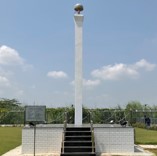
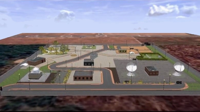
To accomplish the objective of setting up a national resource centre, NCG is trying to set up a Geodesy village at IIT Kanpur. This involves setting up a core site, also called as a fundamental site. This site is a kind of geodetic observatory which helps in refining the global geodetic reference frame, e.g. the International Terrestrial Reference Frame (ITRF). Observations from different co-located instruments are synergistically used for this purpose.
The following Video gives an overview of the site-plan of the Geodesy Village:
International GNSS Service (IGS) Station
Continuously Operating Reference Station (CORS) established adhering with the International GNSS Service (IGS) standards and guidelines. It consists of Trimble Alloy GNSS reference receiver. The station is registered in the IGS station network list and is first from India to be a part of the Asia-Pacific Reference Frame network.
This reference station tracks GPS, GLONASS, Galileo, BeiDou, QZSS, and NavIC (IRNSS) signals. The station provides continuous tracking and transmits daily, hourly and high-rate data to Geoscience Australia and Crustal Dynamics Data Information System (CDDIS). The major aim of this station is to participate in the International Terrestrial Reference Frame (ITRF) realization.
Site Name: IIT Kanpur
The station is operational from 31-03-2021, installed, managed, operated, and maintained by the National Centre for Geodesy, IIT Kanpur. The site will contribute to the ITRF realization and Earth orientation parameter computations.
Data from the IGS station is available on: https://igs.org/network/#station-map-list |