Intranet | Webmail | Forms | IITK Facility
![]()
![]()
![]()
![]()
![]()
Instruments for Imaging and Ranging
|
|
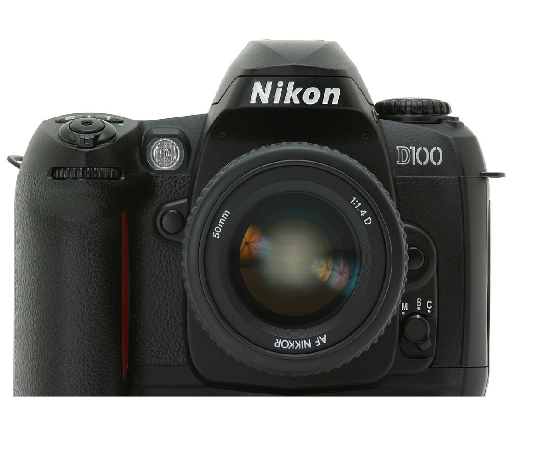
D100 Nikon Camera The D100 has a six-megapixel sensor, a body loosely based on the F80 (although Nikon is keen to note that it shares only some of its components with that camera), a Nikon F mount and a set of features which make it an extremely attractive and capable proposition. |
|
|
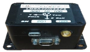
GPS/INS GPS/INS is the use of GPS satellite signals to correct or calibrate a solution from an inertial navigation system (INS). Inertial navigation systems usually can provide an accurate solution only for a short period of time. |
|
|
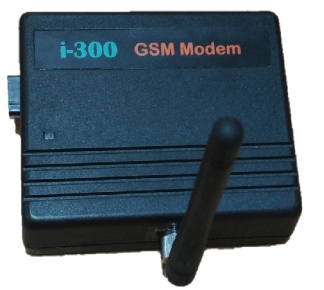
I300 gsm modem I300 gsm modem is a tri-band Gsm modem that supports only 900, 1800, 1900 MHZ band. It has a simple serial interface & can accept any GSM network operator SIM card and act just like a mobile phone with its own unique phone number. The modem can either be connected to the PC serial port directly or to any microcontroller. |
|
|
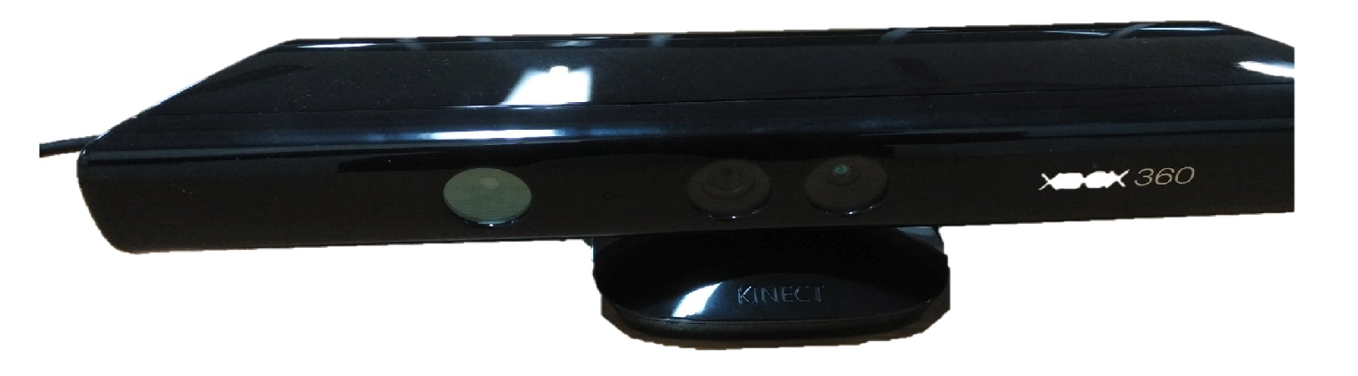
Kinect 360 sensor Kinect 360 sensor is a motion sensor that provides a natural user interface (NUI) that allows users to interact intuitively and without any intermediary device, such as a controller. |
|
|
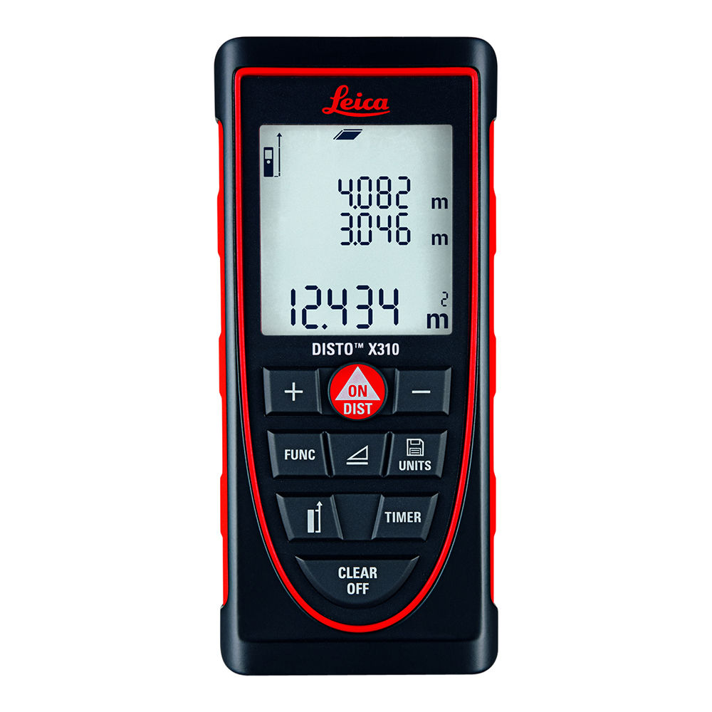
Laser Distance Meter Leica The innovative hand-held laser meter for fast and easy distance measurements of length, squares, and volumes with the press of a button. |
|
|
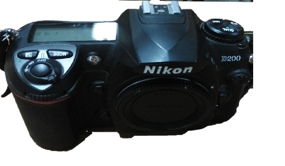
Nikon D200 The Nikon D200 has 10.2 megapixels DX-format CCD image sensor that captures images with edge-to-edge sharpness and incredible color at 3,872 x 2,592 pixels, yielding extraordinarily high-resolution images perfect for enlargements or creative cropping. |
|
|
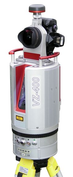
Terrestrial Laser Scanner RIEGL The V-Line 3D Terrestrial Laser Scanner RIEGL VZ-400 provides high speed, non-contact data acquisition using a narrow infrared laser beam and a fast scanning mechanism. High-accuracy laser ranging is based upon RIEGL’s unique echo digitization and online waveform processing, which allows achieving superior measurement capability even under adverse atmospheric conditions and the evaluation of multiple target echoes. The line scanning mechanism is based upon a fast-rotating multi-facet polygonal mirror, which provides fully linear, unidirectional and parallel scan lines. |
|
|
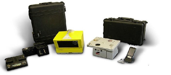
Terrestrial Laser Scanner Optech ILRIS 3D The Optech ILRIS Scan software solution is an all-in-one scanning, viewing, and processing software tool developed for the Optech ILRIS Terrestrial Laser Scanner in partnership with Italian software solutions company Gexcel srl. Combining Optech’s powerful, fully functional ILRIS API with Gexcel’s geomatics experience, ILRIS Scan provides a single interface for the entire survey workflow, from scanning to processing to data review. With ILRIS Scan, you can make your surveys faster, easier, and more efficient than ever before. |
|
|
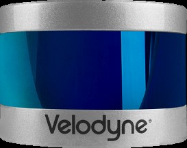
Velodyne Puck LIDAR Sensor The Puck is a small, compact LIDAR that is optimized for usage across a variety of applications, including automotive, mapping, robotics, security, smart cities and more. The Puck’s reliability, power-efficiency, and surround view make it the ideal solution for affordable low speed autonomy and driver assistance applications.The Puck, built on Velodyne’s ‘558 patent, provides a full 360-degree environmental view to deliver accurate real-time 3D data. |
|
|
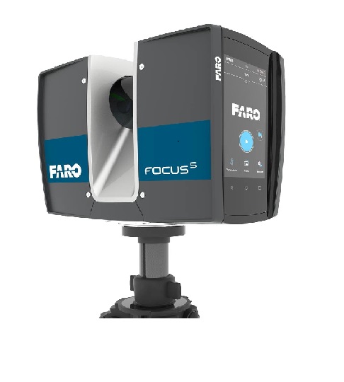
FARO FocusS LIDAR Sensor The FARO FocusS 350/350 Plus is specially designed for outdoor applications due to its small size, extra light weight and extended scanning range. The FocusS 350 provides scanning results even in challenging environments, narrow job-sites, dusty or humid areas, in rain or direct sunlight applications. An on-site compensation tool allows data quality optimization on-site. Integrated GPS & GLONASS receiver enable easy positioning. HDR imaging and HD photo resolution ensure true-to-detail scan results with high data quality. |
|
|
Trimble V10 Imaging Rover 12 calibrated cameras capture 60 MP panorama for full site visualization. Generate Survey, GIS, or mapping accuracy positions from images. Rapid data collection with one-button capture of panoramas. Familiar, easy-to-use workflows in Trimble Access field software. Seamless integration with the Trimble R10 GNSS receiver or Trimble VISION total stations. Flexible, simple processing in Trimble Business Center to generate deliverable. |
|
|
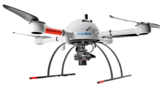
Microdrones At Microdrones, our goal is always to empower you to deliver the best possible work while cutting costs, saving time, and completing projects more easily. mdSolutions were developed with the realities of your job in mind. Our mdMapper packages combine industry-leading UAVs with payloads that were specifically designed for industrial applications like surveying, mapping, inspection, construction, mining, volumetric, and precision agriculture. These packages and kits provide complete solutions that include aircraft, sensors, accessories, custom mounts, and even an Android tablet app that makes it easy to plan, monitor, adjust, and analyze your missions anywhere. |
|
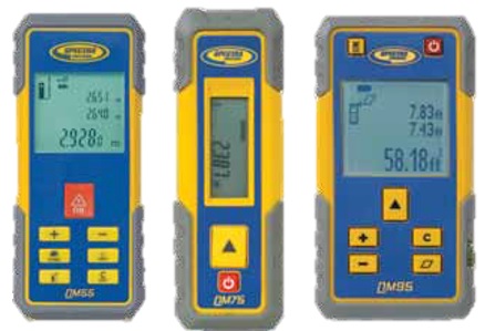
|
Spectra Precision QM Laser Distance Meters The QM Quick Measure laser distance meters are the first family of distance meters designed specifically for the tough construction site environment. The housing is made of durable engineered plastic with extensive use of protective rubber over mold. The electronics have been cleverly isolated resulting in a product that survives a drop and the typical rough conditions found on job sites. |