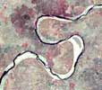
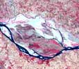
How many Meters the Kosi River shifts westward yearly?
Which area will be flooded next time?
How long the rivers have taken to evolve to present configuration ?
...
|
|
|
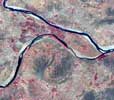
All these questions can only answered by long lasting observations,
investigations and analysis of spatial data. The remote sensing technology has
made a significant contribution in studying the geomorphology of river systems
and drainage basins. Given the size and dimension of the rivers draining the
world’s largest alluvial plains, the Indo-Gangetic Plains, and their dynamic
behaviour, satellite remote sensing data have given a tremendous leap to the
understanding of these river systems.
For centuries, rivers remain the perennial source of living for human
civilization. However, these rivers are also responsible for natural fluvial
hazards such as flooding, bank erosion, and lateral shifting and bring enormous
amount of hardship to mankind. The rivers therefore have social as well as
economic relevance. It is the need of hour to understand the controlling factors
of fluvial hazards in detail so that the proper remedial measures may be chalked
out.
India is a country of diverse
geomorphic settings
and each one of these is characterized by distinctive river systems. The aim of
this web site is to provide the first-hand information on geomorphology,
hydrology and sediment transport characteristics of these rivers systems based
on the available literature. Most of the data presented have been generated
through a long-term research programme on fluvial geomorphology and
sedimentology being carried out at IIT Kanpur.
The Indo-Gangetic Plains are the extensive alluvial plains of the Ganga, Indus
and Brahmaputra rivers and their tributaries, which separate the Himalayan
ranges from Peninsular India. They constitute the largest alluvial plain in the
world covering an area of about 1.75 x10⁶ km2 and form a major part of the Indo-Gangetic
Basin. The Indo-Gangetic Basin is an active foreland basin having east-west
elongated shape. The basin formed in response to the uplift of the Himalaya
after the collision of India and China plates. Suess (1893-1909) was the first
to suggest that the Indo-Gangetic depression is a ‘fore-deep’ and was formed in
front of the high crust-waves of the Himalayas as they were resisted in their
southward migration by the rigid land mass of the Peninsula. The sedimentation
in the basin started with a shallow marine environment, which changed to
estuarine and deltaic one with time. By Mid-Miocene, the sedimentation was
dominated by fluvial environment and it continued to the recent. Sedimentation
in the basin was influenced by tectonism throughout its evolution. At present,
the basin is being filled by the sediments of Indus, Ganga and Brahmaputra
rivers. The vast Indo-Gangetic plains (see
map) are divisible into several sub-basins separated by sub-surface ridges.
Click here to see map (1280x1024)
Click here to see map (800x600)